
Grab the Jackets! Coldest mornings of the season set for Central Florida
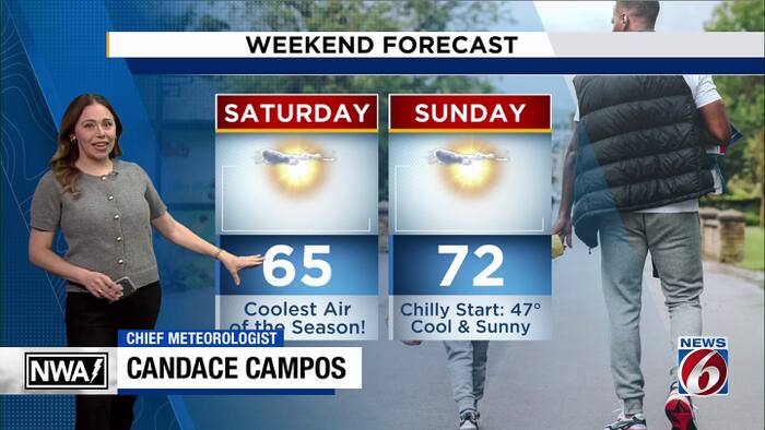
Central Florida is about to get its biggest taste of fall so far this season as a cold front clears early in the day setting the stage for our coldest mornings yet.
Here’s a look at the timeline.
FRIDAY
We’ll start Friday morning with temperatures in the 50s and 60s, but don’t expect much warming throughout the day. Afternoon highs will struggle to reach the 70s.
Winds will also pick up out of the northwest, with gusts approaching 20 mph at times.
SATURDAY
Saturday morning is shaping up to be the coldest of the season for much of Central Florida. Expect actual temperatures in the 40s and 50s, with wind chills dipping into the low to middle 40s across much of the interior.
Despite plenty of sunshine, temperatures will have a hard time climbing much beyond the 60s Saturday afternoon. A few spots along the southern coast could approach 70 degrees.
SUNDAY
Sunday morning will bring another round of chilly temperatures, with many inland communities waking up in the 40s.
By Sunday afternoon, temperatures will rebound into the 70s.
NEXT WEEK
The warming trend continues into next week as winds turn onshore, bringing increasing moisture back into Florida.
That will also bring our next opportunity for rain, potentially as early as Monday, with rain chances increasing into Tuesday and Wednesday.
There are still some significant differences in the forecast models regarding the development and track of a possible disturbance moving toward the Gulf and Florida.
Depending on how that system develops, we could see periods of heavier rainfall, particularly along the coast.
It’s too early to pin down exactly where the heaviest rain could develop, so we’ll be watching that forecast closely over the coming days.