
Chilly start to Sunday before a work week warmup
Sunday
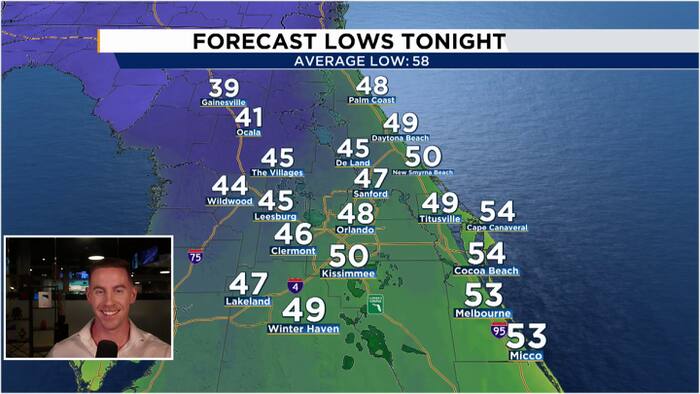
Light NNW winds will persist overnight Saturday and into Sunday morning. This will allow temperatures to once again fall into the upper 40s for many of our neighborhoods. We will see plenty of sunshine all day long, partnered with a northeasterly wind shift, helping to warm up our highs a little more for Sunday afternoon. We will enjoy a picture perfect day with highs reaching the low-mid 70s.
Work Week
Our onshore wind shift will persist into the upcoming work week. This will allow a gradual warmup as the week rolls on. By Monday morning, our lows will be in the upper 50s to low 60s. Highs will reach the mid 70s and we will notice a few more fair weather clouds in our skies. By Mid-week, our onshore winds will grab a pocket off moisture off the Atlantic and help to raise our rain chances for the second half of the week. Rain chances will hover in the 30-40% range starting Wednesday. Unfortunately, most of these showers will hug the coastline where they do not need the extra rainfall. This onshore wind will also be fairly strong offshore, around 25-30kts, which will agitate the Atlantic waters once again, leading to rougher surf.