
Chances grow for historic El Niño: Here’s what that means for Florida
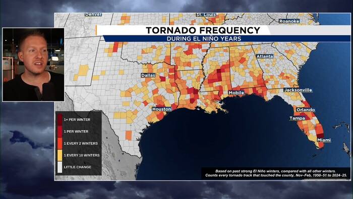
In its monthly update, the climate prediction center increased the probability that the current El Niño event will reach historic levels.
The agency is now giving this current El Niño a 60% chance to be the strongest event since reliable recordkeeping began in 1950.

The current predictions would have this event surpassing recent events, such as 2015/2016, 1997/1998 and 1982/1983.
It is important to note that stronger events do not always mean bigger weather and climate impacts, but they do make it more likely.
The agency also confirmed that warming in the Niño 3.4 region in the equatorial Pacific surpassed the temperature anomaly of 2°C.

This is significant as the current El Niño event is considered “very strong,” the highest on the categorization scale.
While no two El Niño events are exactly alike, significant winter impacts to Florida are typical.

Historically, very strong El Niño events bring increased potential for heavy rain and severe weather including tornadoes.

For a deeper look at potential impact for the winter of 2026/2027 in Florida click here.
The El Niño is expected to rapidly weekend by late spring or early summer of 2027 which could have implications for the upcoming hurricane season.
El Niño typically helps keep the season quieter than normal as we have seen thus far during the current season.