
Coldest air of the season arrives tonight
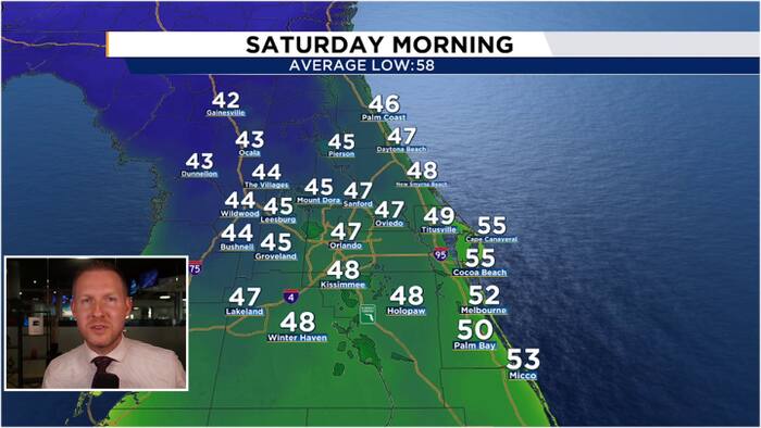
The strongest front so far this season has cleared Central Florida. This will bring a weekend cold blast to our neighborhoods. These are temperatures we have not felt in 8 months!
Tonight
Northwest winds continue to funnel cold, dry air into Central Florida under crystal clear skies. This combo of clear skies, dry air, and northwest winds will allow our Saturday morning low temperatures to fall into the mid-upper 40s for most of Central Florida! Coastal cities will see low-mid 50s. Areas north and west of I-4 will see morning lows in the low-mid 40s.
Saturday
Clear skies and bright sunshine will rule the day after starting off the weekend in the 40s! Even with bountiful sunshine, high temperatures will struggle to heat up into the mid 60s as northwest winds will continue to bring cold air into Central Florida.
Sunday
Light NNW winds will persist overnight Saturday and into Sunday morning. This will allow temperatures to once again fall into the upper 40s for many of our neighborhoods. We will see plenty of sunshine all day long, partnered with a northeasterly wind shift, helping to warm up our highs a little more for Sunday afternoon. We will enjoy a picture perfect day with highs reaching the mid 70s.