
Flooding continues along St. Johns River as cooler weather arrives this weekend
Central Florida is getting a break from the heavy rain, but the flooding story is far from over. Water from this week’s excessive rainfall upstream is continuing to move north through the St. Johns River basin, and river levels could get worse before they begin to improve.
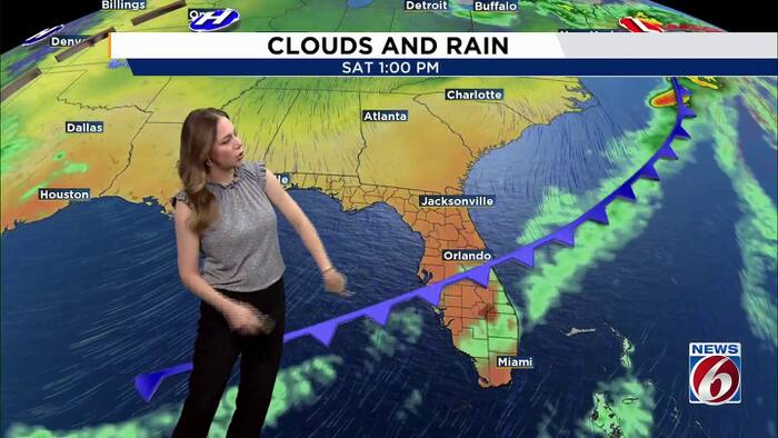
A few showers are possible today, but widespread rainfall is not expected. A cold front will move through Saturday, bringing somewhat cooler temperatures for the second half of the weekend.
St. Johns River update
Even though the heavy rain has moved out, water from the upper St. Johns River basin is still making its way downstream.
A prolonged river flooding event is ongoing, especially along the St. Johns River. With a considerable volume of water moving north, conditions are likely to worsen before improvement begins.
Friday forecast
Moisture will increase slightly ahead of an approaching front, bringing a few isolated showers into the afternoon.
Temperatures will stay warm, with highs reaching the mid-80s and light winds.
Cold front arrives Saturday
A cold front will push through Central Florida Saturday, but don’t expect a big rainmaker. Limited moisture along the boundary should keep the passage mostly dry.
Winds will shift out of the north and northwest behind the front, allowing temperatures to gradually cool.
Highs will still reach the low to mid-80s Saturday before settling closer to seasonal averages Sunday through Wednesday. Expect upper 70s to lower 80s for highs, with overnight lows dipping into the upper 50s in areas northwest of I-4 and the 60s elsewhere.
Next week outlook
Most of Sunday looks dry, with only a 10% to 20% chance of rain across much of the area Monday through Wednesday.
A weak disturbance could bring scattered showers Thursday, but forecast models still differ on the timing. Severe weather is not expected with this system.